SCANNING TECHNOLOGIES
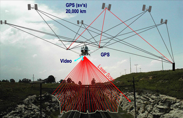
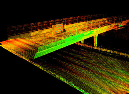
3D laser scanners represent a modern technology that accurately measures the fine detail in millimeters and captures irregular shapes to quickly generate point clouds.
The technology is ideally suited to the measurement and inspection of contoured surfaces and complex geometries which require large amounts of data and where the use of conventional measurement methods is ineffective.
Due to its high accuracy, the 3D laser scanner technology can be used in various fields such as forest inventory, restoration of cultural heritage or building modelling, construction of roads/highways etc.
Our company's performance is closely related to the use of these technologies in an innovative way, either terrestrial or aerial, for different purposes in various projects.
Today, TOPOEXIM provides the following scanning services:
-
Realizing the measurement in various areas:
- Survey of already existing Power Lines with the aim of determining the condition of catenaries and of identifying possible obstacles
- Survey of cross sections for road projects
- Survey of railway lines with the aim of taking the inventory of all infrastructure components
- Survey of roads with the aim of improving service ability
- Survey of façades
- Survey of industrial installations;
- As built production for road and railway infrastructure
- Monitoring trees growth
- Monitoring excavations
- Digital Surface Model (DSM)
- Digital Terrain Model (DTM)
PROJECT: