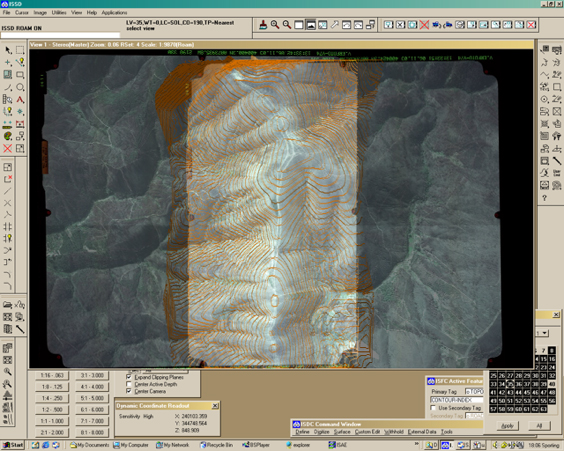
PHOTOGRAMMETRY
Photogrammetry is one of the modern technologies used to obtain aerial photograms by exploring qualitatively and quantitatively the information obtained for rapid processing and for developing topographic plans, digital models and ground surface models.
The proposed photogrammetric services are based on cutting-edge technologies and are widely used, both as stand-alone aerial photography works and as support for other types of projects. These can be performed for large areas of land by using airplanes or helicopters or for multiple segments by using drones.
Types of services:
- Drafting of flight plans and execution of photogrammetric flights
- Determination and identification of pre-markers or benchmarks in photograms
- Creation of orthophotoplans at various scales
- Development of the digital terrain model
- Volumetric calculations